OmniLoc.AI delivers a next-generation, hardware-agnostic localization platform enabling reliable positioning in GPS-denied and GPS-degraded environments.

Scroll

Two markets. One missing signal.

GNSS is the single point of failure in the air and the single largest line item on the ground.

Air UAVs & defence

GPS jammed or spoofed — the mission stops.

GPS jammed or spoofedNavigation corruptedNo trusted position

  • Mission interruption
  • Unsafe navigation
  • Incorrect landing zone
  • Lost payload data and repeat flights
Ground OEMs & robotaxis

Sub-metre accuracy costs €10–20K per vehicle.

Sensor bill per vehicleHD map requiredNo map, no fallback

  • A hardware cost on every vehicle built
  • Localizes only where an HD map already exists
  • No graceful degradation when GNSS drops
  • Map maintenance scales with every new city
One technology

HD Mapping & CrossView Geolocalization

Fusing perspectives for absolute accuracy.

Our proprietary SLAM technology aligns ground-level data with satellite imagery in real-time. By locking onto precise environmental features, we eliminate GPS drift entirely.

How CrossView works

Four stages, one absolute fix.

01 Sensing

Local view

The camera already on the platform delivers a live frame — no new sensor stack.

02 Geometry

View normalization

The frame is warped towards a nadir view, removing pitch, roll and perspective.

03 Retrieval

Aerial matching

The normalized view is matched against geo-referenced satellite and aerial imagery.

04 Gating

Pose alignment

Geometry gating rejects lookalikes and resolves a single absolute global pose.

No GNSS No HD map dependency No new sensor stack
01 Air UAVs & defence

Aerial Autonomy

Expanding perception beyond the horizon.

One embedded unit carries the whole OmniLoc stack onto any airframe: under 200 g, MAVLink straight into the flight controller, and CEP95 under 2 m of absolute global position while GNSS is jammed, spoofed or simply unavailable. Everything is computed on board — no datalink, no ground station, no map pre-built for the area.

Track 01 · in the air

The signal goes. The position does not.

GNSS Nominal
Source Satellite
Error 0.8 m
Scroll
CrossView fix — absolute, map-anchored Inertial-only estimate — error accumulates
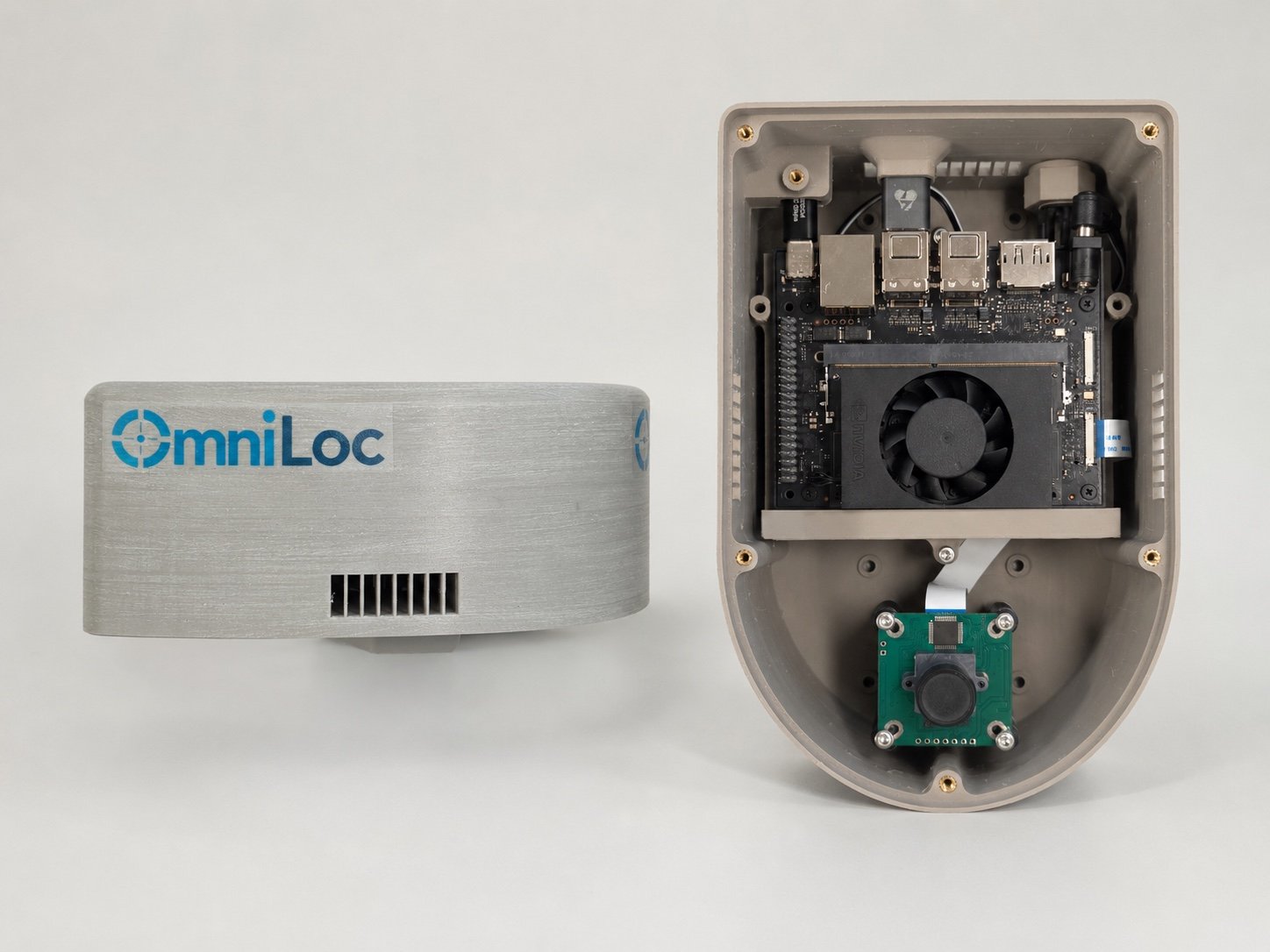
The OmniLoc All-in-One Unit: the closed enclosure beside an opened one showing the NVIDIA compute module and the downward-facing camera.
Closed enclosure and internals — NVIDIA compute module, downward-facing camera.
Product · Hardware

All-in-One Unit

A sealed, flight-ready localization unit. Bolt it to the airframe, connect MAVLink, and the aircraft has an absolute global position that does not depend on a satellite signal.

Absolute accuracy
CEP95 < 2 m
Mass
Under 200 g
Integration
MAVLink to the flight controller
Inside
Camera, NVIDIA edge compute, satellite imagery on board
Link required
None — no datalink, no ground station
Prior mapping
None — no HD map of the area
Validated with A UAV manufacturer Greece
How you buy it

Unit purchase, then a licence per active unit. You buy the hardware once per aircraft and hold an annual embedded-SDK licence on the units you keep flying. Fleet integration is quoted per deployment.

Discuss a UAV deployment →

In the air · three conditions

Same unit, as the signal degrades.

01 Signal correction GPS present but noisy. The map-anchored fix pulls the position back onto truth.
02 Jammed signal The signal is actively contested. Lock is held through the jamming and recovered instantly.
03 Denied environment No usable signal at all. Full autonomy continues on the camera and the map alone.
02 Ground OEMs & robotaxis

Scalable Hardware Sets

Hyper-Sensing & Data Enhancement.

Modular product kits designed to elevate affordable hardware to premium-grade performance through advanced AI, ensuring trustworthy perception for any autonomous system.

Product · Software

Embedded SDK

No new hardware ships. The SDK integrates into the existing perception stack and runs INT8-optimized models on the silicon the vehicle already carries.

Absolute accuracy
Centimetre-level
Hardware cost
Up to 90% reduction
Sensors
The vehicle's own cameras — no dedicated localization suite
Runs on
TI TDA4x and AM69A, NVIDIA Jetson Orin
HD map
Not required — works where no map exists
Role
Primary localization, or sub-metre backup behind GNSS
Validated with An automotive OEM Germany · Vietnam · Greece
How you buy it

An annual licence per vehicle. A one-off integration and platform fee brings the SDK into your stack; after that you licence it against the vehicles in the field, with support and each new city deployment quoted separately.

Discuss an OEM pilot →
Your stack Planning & control
OmniLoc CrossView Embedded SDK absolute global pose, cm-level
Your silicon TDA4x · AM69A · Jetson Orin
Your sensors Existing vehicle cameras

Nothing new is added to the vehicle. The SDK sits between the sensors you already fitted and the stack you already wrote.

Automotive CrossView Ground-vehicle localization running in real time on TI TDA4x and NVIDIA Orin.
03 Cloud Geospatial & enterprise

Geospatial API

Localize imagery you already hold. No vehicle, no integration, no hardware — you call it and you pay for the call.

Image endpoint

Submit a frame, receive an absolute geo-referenced pose. Priced per image processed.

Video endpoint

Submit footage, receive a geo-referenced track across the sequence. Priced per minute processed.

On-premise deployment

The same engine inside your own network, for imagery that is not allowed to leave it. Licensed annually.

New area onboarding

Reference imagery prepared and validated for a new geography, quoted per region.

How you buy it

Per call. Usage-based pricing on images and video minutes, with an enterprise or on-prem licence when the data cannot go to the cloud. No per-vehicle commitment and no hardware.

One stack, three ways to take it

The same CrossView engine underneath. What differs is what ships and how you pay for it.

  01 · Air All-in-One Unit 02 · Ground Embedded SDK 03 · Cloud Geospatial API
Built for UAVs and defence platforms Autonomous vehicles and robotaxis Geospatial and enterprise imagery
What ships A sealed hardware unit, under 200 g Software only — no new hardware An endpoint, or a container on your own network
Absolute accuracy CEP95 < 2 m Centimetre-level Per-frame geo-referenced pose
Runs on Compute inside the unit TDA4x · AM69A · Jetson Orin Our cloud, or your on-prem hardware
Integration MAVLink to the flight controller Embedded into the perception stack An API call
How you pay Per unit, plus an annual licence per active unit Per vehicle, annually, after an integration fee Per call — per image or per video minute
The hard part

Finding a match is easy.
Avoiding the wrong one is not.

From above, many places look almost identical — roads, fields, rooftops, tree rows, parking lines, solar panels, industrial yards. A standard matcher will happily lock onto a tile that looks right locally and is geographically wrong, and it will report high confidence while doing it.

Scanning corridor 8 candidates
  • 01
  • 02
  • 03
  • 04
  • 05
  • 06
  • 07
  • 08

Eight candidate tiles along the corridor. Watch what each method does with them.

Standard visual matching Commits to the strongest appearance score — tile 02
OmniLoc · geometry-gated Rejects every candidate that fails geometric consistency — tile 05
01

Height-ambiguity solver

Scale and altitude trade off against each other in a single view. Resolving them separately is what stops a correct-looking match at the wrong distance.

02

Domain-gap optimizer

Reference imagery was captured in another season, another light, from another sensor. The optimizer closes that gap so the comparison is of places, not of photographs.

03

Geometry gate

Every surviving candidate must agree with the platform's own motion and viewing geometry. Appearance alone never carries a fix.

Repetitive-environment sequence — the gate holding lock where appearance alone does not.

Trusted Across Critical Industries

Active proof-of-concept deployments with leading OEMs and system integrators.

Defense

Autonomous navigation for UGVs, UAVs, and UWVs in contested and GPS-denied theatres. Reliable real-time localization for mission-critical operations where signal integrity cannot be guaranteed.

GPS-Denied Navigation Anti-Jamming ISR Platforms

Critical Infrastructure Protection

Autonomous perimeter monitoring and asset tracking for energy installations, ports, and transportation networks. Persistent situational awareness without reliance on vulnerable GNSS signals.

Perimeter Security Asset Tracking Energy & Ports

Public Safety

Real-time situational awareness for first responders and law enforcement. Drone-based localization for rapid deployment in emergency scenarios where existing infrastructure may be compromised.

First Responders Situational Awareness Rapid Deployment

Civil Protection

Disaster response and search-and-rescue operations with coordinated USV and drone teams. Centimeter-level positioning for damage assessment and survivor location in post-disaster environments.

Disaster Response Search & Rescue USV & Drone Coordination

Interested in a proof-of-concept for your use case?

We work with OEMs and software solution providers to validate Omniloc's capabilities against your specific operational requirements.

Schedule a Discussion →
Our Story

What We Do

OmniLoc delivers AI-driven localization solutions that enable autonomous systems to operate reliably even in GPS-denied environments. By fusing multi-sensor data with satellite imagery and advanced computer vision, our technology provides precise, real-time positioning and scene understanding.
Our framework leverages cooperative learning and efficient AI models to achieve high accuracy with reduced data and energy requirements, while ensuring scalability through model optimization and deployment tools.
The result is centimeter-level, real-time localization and enhanced environmental awareness, improving safety, reliability, and performance across autonomous vehicles, drones, robotics, and defense applications.

Our Leadership

Motivated by a strong commitment to bring cutting-edge localization technologies into real-world applications, OmniLoc was founded by a team with extensive experience in AI, computer vision, and autonomous systems.
The team has contributed as Principal Investigators and Technical Coordinators in several EU-funded projects and industrial R&D contracts, with work spanning perception, localization, security, and autonomous driving technologies.
OmniLoc develops advanced AI-driven localization solutions that fuse multi-sensor and satellite data to enable precise, reliable positioning, even in GPS-denied environments, enhancing the safety and efficiency of autonomous vehicles, drones, and robotic systems.

Technological Roadmap

Precision localization everywhere.

Research & Development

Analysis, understanding, scene prediction, and control of the vehicle, UAV, or semi-autonomous robotic systems used in precision applications, in order to rapidly eliminate operational risks.

Short-Term Solutions

  • Deployment of pilot projects with key partners (e.g., drones, autonomous vehicles, warehouse robotics) using the existing online service
  • Integration of the platform into customer systems via APIs/SDKs for rapid adoption
  • Optimization of cross-view geolocalization models for specific use cases (logistics, UAVs, defense)
  • Validation in real-world environments to improve robustness under GPS-denied and degraded conditions
  • Expansion of early customer base through targeted B2B collaborations

Long-Term Vision

  • Establish OmniLoc.AI as the global standard software layer for GPS-independent localization
  • Enable full autonomy across industries by eliminating reliance on expensive hardware and unreliable GPS
  • Scale into international markets (automotive, defense, smart logistics, robotics ecosystems)
  • Develop a unified, real-time geospatial intelligence platform combining localization, mapping, and situational awareness
  • Power next-generation multi-agent autonomous systems with seamless, cooperative perception worldwide

The Team

The brilliant minds driving Omniloc's innovation.

Aris Lalos

Aris Lalos

Founder & CEO
Alexandros Gkillas

Alexandros Gkillas

Chief Technical Officer & AI Engineer
Christos Anagnostopoulos

Christos Anagnostopoulos

Senior Platform & Simulation Engineer
Nikos Piperigkos

Nikos Piperigkos

Senior Signal Processing & AI Engineer
Nikos Poulopoulos

Nikos Poulopoulos

Computer Vision Engineer
Evgenia Orfanou

Evgenia Orfanou

Communication and Project Administrator
Ioulia Kapsali

Ioulia Kapsali

Computer Vision Engineer
Nikolas Potamianos

Nikolas Potamianos

Computer Vision Engineer
Andreas Katsaros

Andreas Katsaros

Computer Vision Engineer

Latest News

June 2026

Check out the new article about OmniLoc.ai in Startupper.gr! 📰✨

Check out the new article about OmniLoc.ai in Startupper.gr! 📰✨

Startupper.gr has highlighted OmniLoc.ai as one of Greece’s emerging deep-tech companies, following our win at the Startup World Cup Greece 2026 during BEYOND.The article presents how OmniLoc is developing AI-based localisation technologies for autonomous systems operating in GPS-degraded and GPS-denied...

Read more →

June 2026

OmniLoc Wins Startup World Cup Greece 2026: Next Stop San Francisco

OmniLoc Wins Startup World Cup Greece 2026: Next Stop San Francisco

🏆 We are incredibly proud to announce that OmniLoc has been named the winner of the Startup World Cup Greece 2026! 🇬🇷🚀This achievement earns us the opportunity to represent Greece at the Startup World Cup Grand Finale in San Francisco,...

Read more →
June 2026

Science Agora Networking & Pitch Elevation event

Science Agora Networking & Pitch Elevation event

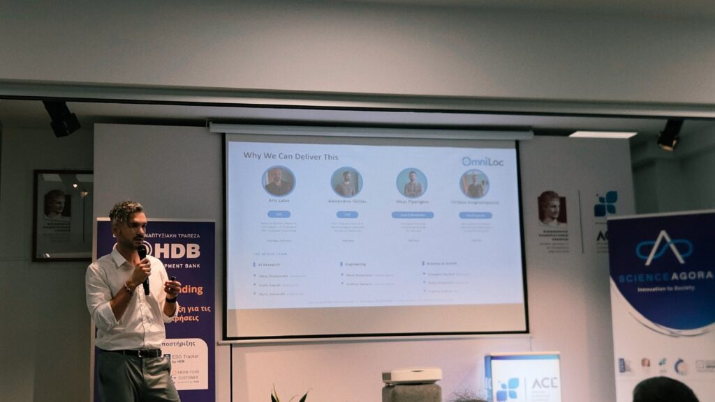
On 12 June 2026, the OmniLoc team participated in the Science Agora Networking & Pitch Elevation event, part of the Proof-of-Concept for Emerging Technologies programme, implemented by Science Agora – Innovation To Society in collaboration with the Hellenic Development Bank...

Read more →
Visit our Blog →

Partners & Supporters

Backed by world-class institutions and programs.

Ready to Elevate Your Perception?

Schedule a live demonstration of the Omniloc platform.

See our HD Mapping, Hyper-Sensing Kits, and AI algorithms in action. Pick a time that works for you, and our engineers will walk you through a custom technical overview.

Select a Date

Available Times (EET)

Your Email